Trip Itinerary:
Day 01: Kathmandu. Arrival Kathmandu Airport Transfer to Hotel. Free stay.
Day 02: Kathmandu. Trekking Preaparation Day. Free stay.
Day 03: Kathmandu – Biratnagar - Suketar (820 Mtr) 8 Hrs.
The journey begins with an internal flight eastwards to Biratnagar, on the edge of the Indian plains, where we check into our hotel and have a free afternoon. Drive to Suketar By sharing Jeep. OverNight at Suketar.
Day 04: Suketar – Mitlung (850Mtr.) 6 hrs
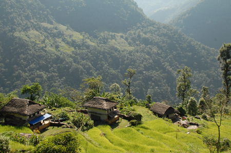
After breakfast trek down to the village of Asahangpati and on to the Tamor Khola. This major river, and its tributaries, carries the waters off all the mountains to the north to the Ganges. Most villages are situated on high gentle slopes above steep sided valleys where agriculture is possible. We follow it upstream through bird filled forest, to the Chhetri village of Mitlung. Overnight at Mitlung.
Day 05: Mitlung - Chirwa (1,190m) 7 hrs
Today’s trail passes through dense patches of sub-tropical rainforest and follows the valley, from village to tributary crossings and up again. The region is home to ethnic Kirantis, now known as Limbus, who are chiefly involved in traditional agriculture. Beyond Sinwa, the valley narrows and the trail picks its way over landslides to Tawa. There are many bee hives in this region. Chirwa is a delightful cluster-village set amongst boulders: the campsite is next to a stream beyond the village. Overnight at Chirwa.
Day 06: Chirwa - Sekathum (1,640m ) 6 hrs
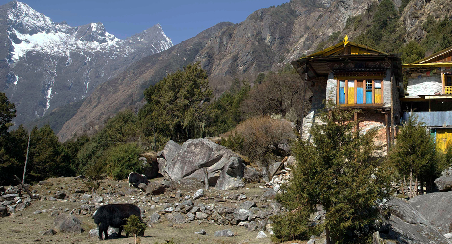
Now the valley broadens and the landscape changes subtly. Cross the Sisuwa Khola and continue to Tapethok; the entrance and checkpoint to the Kangchenjunga Conservation Area. Wealthy cardamom farms surround the village. Follow the trail to a bridge over the Tamewa Khola and Tamewa and continue to Hellok. (Between these villages, a bridge leads west to the hilltop village of Lelep: headquarters of the KCA project.) Beyond Hellok, a suspension bridge crosses the Simbuwa Khola: the river that rises from the Yalung Glacier on Kangchenjunga’s south face. The next bridge crosses the Ghunsa Khola that rises from Kangchenjunga’s north face glacier. This is at its confluence with the Tamur Khola just below the village of Sekathum. The first views of Khumbakarna (Jannu) may be seen. Overnight at Sekathum
Day 07: Sekathum - Amjilosa (2,490m ) 6hrs.
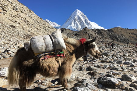
After breakfast, we follow the trail along the north bank of the Ghunsa Khola which is set in a steep sided and narrow valley. It passes through oak and rhododendron forest with bamboo undergrowth as well as small Sherpa settlements, mainly tending yaks: there is still evidence of extensive forest burning for slash-and-burn agriculture. After lunch, there is a steep climb up to the small and friendly Tibetan settlement of Amjilosa, set on a small level kharka with great views back down the valley. Overnight at Amjilosa.
Day 08: Amjilosa - Gyabla (2,730m ) 5hrs.
This is a fairly short day. The trail leads up to a flat ridge and then meanders through forests of bamboo, rhododendron, birch and brown oaks. It passes waterfalls and a few scattered summer pastures. Eventually it reaches a large set of rapids, after which a stiff climb leads up to the Sherpa village of Gyabla. The slopes around the village have been denuded for fields, but the forest remains pristine on the opposite side of the valley. Overnight at Gyabla.
Day 09: Gyabla - Ghunsa (3,430m ) 6hrs
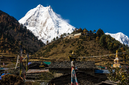
Today’s trail passes through hemlock and bamboo forest as it drops steeply into a ravine before levelling out. The forest gradually changes to alpine Himalayan fir and rhododendron as the path rises towards the large summer yak pastures and potato fields around the village of Phale (3,140m/10,302ft). There is a wooden Gompa with several statues and old thangkas, brought originally from Tibet. Beyond Phale, the valley widens and the trail improves as it passes through larch forests and cultivated fields. It then dips down to cross the Ghunsa Khola and enter Ghunsa. This is the largest village in the region and is now occupied throughout the year: swelling in numbers as yaks and goats are brought up (and beyond) to pasture during the summer months.
Day 10: Ghunsa - Kambachen (4 150m ) 6 hrs.
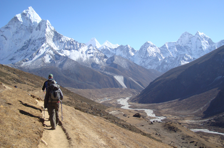
The trail leads north of Ghunsa through glorious larch and juniper forests on the east bank of the Ghunsa Khola. After crossing a sandy, boulder-strewn floodplain it crosses the river over a rickety, wood and stone bridge before climbing above the west bank to Rambuk Kharka (3,720m/12,205ft). The hillsides become increasingly barren as the trail rises past a high waterfall and rock falls along a narrow trail. Further on it crosses a large, sandy landslide before climbing more steeply while passing the impressive snout of the Khumbakarna (Jannu) Glacier on the opposite side of the valley. It then drops briefly into Kambachen. From here there are great views of several peaks including Jannu (7,710m/25,295ft). Lammergeyers, eagles, kites, falcons and choughs are commonly seen. Overnight at Kambachen.
Day 11: Kambachen – Lhonak (4,790m ) 5 hrs
The landscape becomes increasingly desolate; forged over aeons by glacial ice. The path is not strenuous but for a time negotiates the stony river bed before reaching summer-pastoral huts at Ramtang (4,370m/14,338ft). Beyond is the snout of the Kangchenjunga Glacier which has been joined by the Ramtang Glacier. Higher up, the stony path climbs over the moraine and drops to the riverbed of the Ghunsa Khola as it leaves the Lhonak Glacier to the north. Ford the river or cross on a low unstable bridge to the summer grazing kharkas at Lhonak, situated well above the main glacier. There are three small buildings and some old stone walls amongst boulders that can assist with tent-shelter from the icy winds. Ice peaks rise in all directions with the 1½km ridge of Chang Himal (Wedge Peak) as centre piece. Tent Peak is prominent on the eastern horizon at the end of the visible glacier. Overnight at Lhonak.
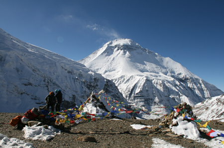
Day 12: Lhonak – Kanchenjunga Base Camp (5,160m ) 3 hrs
From Lhonak the Kangchenjunga Glacier flows eastwards for several kilometres before turning south to rise to its extensive head on the northern slopes of Kangchenjunga. The path follows the lip of the glacier over short grasses or rocky tracks that undulate with the terrain. Pang Pema lies opposite the head of the glacier and from here offers the first full view of the vast north face of the mountain. Overnight at Pang Pema.
Day 13: Kanchenjunga Base Camp .
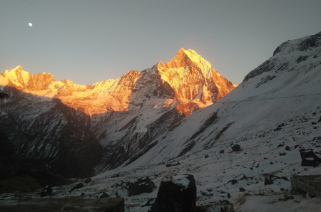
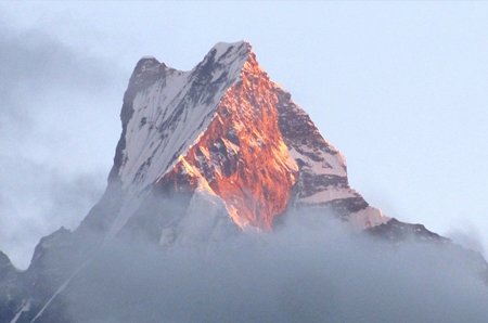
The views from Pang Pema must rank amongst the most spectacular in the world. From Kangchenjunga, an unbroken wall of peaks, nowhere less than 6,100m/20,000ft forms the border with Sikkim and to the north, Tibet. Beyond the campsite the West Langpo Glacier flows into the Kangchenjunga Glacier. A difficult route north leads over the Jonsang La into Tibet. Climb the lower slopes of Drohma Ri (5,500m/18,045ft) behind the camp for better views of the mountain – at sunrise. Walk along the Langpo moraine to Corner Camp for better views of Pyramid Peak, et al. Overnight at Pang Pema.
Day 14: Kanchenjunga Base Camp – Kambachen (4,150m ) 6 hrs
The return journey from Pang Pema to Lhonak will be fairly slow, but beyond that the route is almost all downhill and thus Kambachen can easily be reached in a day. There are great views to enjoy. Overnight at Kambachen.
Day 15: Kambachen – Ghunsa – Phale (3,140m ) 6 hrs
Retrace the path down to Ghunsa, for lunch. Look out for pheasants in the forest. Cross the river below the village and continue downstream beside the Ghunsa Khola, through forest and farmland, to the Tibetan summer grazing village of Phale. Visit the wooden gompa. Overnight at Phale.
Day 16: Phale – Amjilosa (2,140m ) 6 hrs
The trail, through forests of rhododendron, conifer, birch and oak, continues down the valley, dropping to cross numerous tributaries to the last of the Tibetan villages at Gyabla. It then undulates on down to Amjilosa. Overnight at Amjilosa.
Day 17: Amjilosa – Chirwa (1,190m ) 6 hrs
After the waterfall beyond the village, the path begins to descend fairly steeply to Sekathum: at the confluence of the Ghunsa and Tamur Kholas. The path then follows the western bank of the Tamur Khola and soon crosses the suspension bridge over the Simbuwa Khola that flows in from the Yarlung Glacier. An afternoon's walk leads to the riverside campsite a ¼hrs walk before the cluster-village of Chirwa. Overnight at Chirwa.
Day 18: Chirwa – Linkhim (1,520m ) 6 hrs
From Chirwa, leave the river trail and follow the trail that climbs above the east bank of the Tamor Khola to the hamlet at Thiwa (an exit point from the KCA). It then climbs high above the houses of Tawa, over a ridge before dropping into a side canyon to cross the Tawa Khola before climbing back to the ridge. It then passes above the hamlet of Malbanse before reaching Linkhim. Overnight at Linkhim.
Day 19: Linkhim – Suketar (2,700m ) 6 hrs
From Linkhim, the trail winds in and out of side canyons to the Limbu village to Phurumbu and a ridge overlooking a vast landslide before Jogidanda. A final 3-4 hrs climb, through the Sherpa villages of Bung Kulung and Bhote Gaon leads to the airstrip at Suketar . Overnight at Suketar.
Day 20: Suketar – Biratnagar ( 8 Hrs )
After breakfast, catch sharing jeep to Biratnagar. Over Night at Biratnagar.
Day 21: Biratnagar – Kathmandu.
After Breakfast at Hotel. You are transfer to Biratnagar airport for board flight to kathmandu. Transfer Hotel in kathmandu. Free stay at Thamel.
Day 22: Kathmandu Departure.
After Breakfast at Hotel. You are transfer to Kathmandu International Airport three Hours Before your schedule Flight.
.
.